
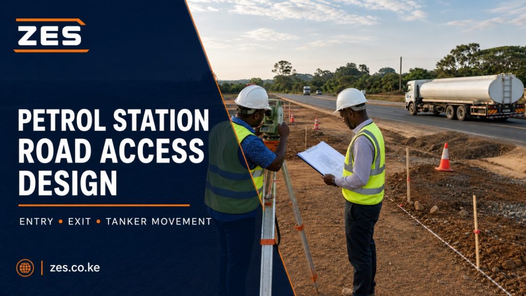
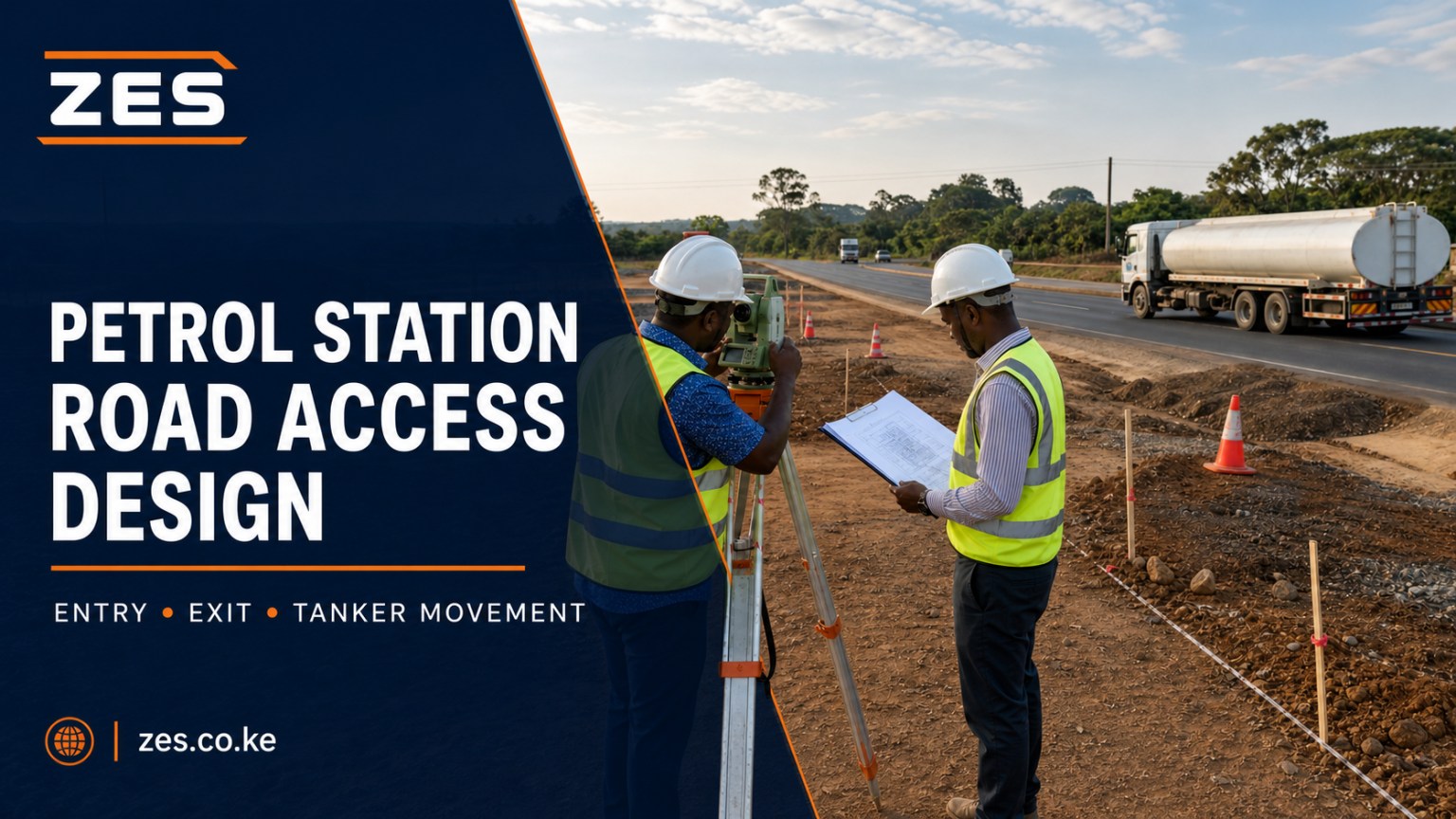
For buyers, petrol station road access design Kenya is not simply a pair of openings drawn on a site plan. It is a survey-led access-geometry package that shows how customers, delivery tankers, pedestrians and through traffic can interact without avoidable conflict. Before you appoint a consultant, the brief should define the entry and exit arrangement, internal queue capacity, tanker swept paths, visibility, road-reserve works and any acceleration or deceleration lanes required by the relevant roads authority.
Access can determine whether an otherwise attractive plot is practical. A driveway that works for a saloon car may fail when an articulated tanker turns in. An entrance placed too close to a junction may create conflicts. A short internal throat may allow a queue to extend back onto the public road. A sign, hedge, parked vehicle or crest can obstruct the view needed by an exiting driver. These are geometric and traffic questions that should be resolved before forecourt levels, dispenser islands, tank fill points and building positions become difficult to change.
This buyer’s guide is deliberately focused on access design procurement. It does not replace a petrol station feasibility study, promise a turnkey construction outcome or guarantee an approval. Zama Engineering Systems (ZES) can coordinate site reconnaissance and agreed civil or forecourt design inputs within its petrol station engineering solution. Qualified roads, traffic, civil and surveying professionals must prepare or take responsibility for work within their competence, while KeNHA, KURA, KeRRA, a county government or another competent road manager retains its statutory review and approval role.
What are you buying when you commission road access design?
A useful commission converts a business and operations brief into a buildable road interface. It should answer where vehicles enter and leave, which movements are permitted, what design vehicles can complete those movements, how much traffic can wait inside the plot, what drivers can see, how levels and drainage connect, and which works may be permitted within the road reserve.
The access package is only one coordinated part of a station layout. Its conclusions affect the forecourt, but it should not quietly expand into an undefined “complete design” commission. State whether the appointment includes concept options, topographic and cadastral survey coordination, traffic data, swept-path analysis, detailed civil drawings, road-authority liaison, a bill of quantities, response to review comments and construction-stage clarification. If an item is excluded, identify who will provide it and by what date.
A buyer should also distinguish design from approval. A consultant may prepare evidence, attend meetings, upload an application and revise drawings in response to comments. The authority may request changes, impose conditions, approve, defer or decline the proposal. A professional scope can commit to competent work and documented coordination; it cannot honestly commit the authority to a predetermined decision.
Identify the road custodian before fixing the layout
Do not choose the approving body merely because the site is in a city, beside a busy road or outside a town. Confirm the road name, classification, reserve and responsible custodian from current official records or written guidance. A mapping label, estate-agent statement or neighbouring development is not reliable proof of jurisdiction.
- KeNHA: its official FAQs say the Authority manages national trunk roads and list Classes S, A and B. The same page identifies access-road approvals as a permit type and directs applicants to the online process.
- KURA: the Authority’s published mandate concerns national urban roads. An urban address alone does not prove that a particular frontage is under KURA; confirm the road inventory and regional direction.
- KeRRA: its official FAQs describe responsibility for rural roads. Again, confirm that the named road and road reserve are actually within its current responsibility.
- County government: a county may be the road manager for a county road and may separately issue development or physical-planning permission. Road-access consent and county development permission are not automatically the same decision, even when county departments participate in both.
There can also be interfaces with a service road, an adopted estate road, a bypass project, a planned road widening or a road whose management has changed. Ask the design team to record the evidence used to identify the custodian and the contact or office consulted. If responsibility remains disputed, resolve that uncertainty before spending heavily on a detailed option that the correct authority has not seen.
How Kenya’s current petroleum rules affect the access scope
Legal Notice 188 of 2025 contains the current Petroleum (Retail Dispensing Site Construction and Licensing) (No. 2) Regulations. The regulations state that construction or modification of a retail dispensing site must be undertaken in accordance with a valid construction permit issued by the Energy and Petroleum Regulatory Authority (EPRA).
The First Schedule is directly relevant to access procurement. The construction-permit requirements list development permission from the respective county government and approval to construct acceleration/deceleration lanes from the relevant roads authority, identifying KeNHA, KURA or KeRRA as applicable. The same schedule lists civil engineer’s drawings for the forecourt layout, surface design, tank cradle and backfill, drainage and oil-water-separator layout, as well as the applicable practising certificates and a priced bill of quantities.
That wording does not mean every plot automatically needs identical acceleration and deceleration lanes. The relevant road authority and qualified roads or traffic designer must determine what is required for the actual frontage, road class, operating speed, traffic conditions and proposed movements. It also does not mean an EPRA construction permit replaces roads, county or environmental decisions. Buyers should use EPRA’s current petroleum licences and permits application guide hub, the regulations, the authority portals and written project-specific directions when compiling the live submission.
Build the design brief around real operations
A designer cannot test geometry properly without knowing who will use it. Prepare an operational brief before options are drawn. It should state the intended products, number and orientation of dispensers, convenience or service uses, operating hours, likely customer vehicle mix, delivery tanker configuration, delivery frequency, staff parking, refuse collection and any separate movements for buses, motorcycles, matatus or heavy goods vehicles.
At minimum, give the design team the following information:
- the title, deed plan, survey plan, lease or other available land records;
- known road name, road number, road class and suspected custodian;
- the proposed plot boundary and any road widening, wayleave or building-line information;
- the expected customer and delivery vehicle types, including the largest credible tanker combination;
- proposed tank fill points, vent area, dispensers, canopy columns, buildings and parking;
- whether the station will operate one-way or permit two-way movement;
- known nearby junctions, median openings, bus stops, schools, markets, crossings and existing accesses;
- peak periods, delivery restrictions and any available traffic or incident information; and
- all previous correspondence, approvals, rejection reasons or authority comments concerning the plot.
The brief should define decisions, not force a preferred sketch to survive every test. If the client insists on two crossovers, a particular pylon position or a tanker route that conflicts with safety or authority requirements, the consultant should record the constraint, test alternatives and explain the consequence.
Surveys and evidence needed before detailed geometry
Aerial imagery is useful for orientation but is not a detailed design survey. The project normally needs a properly controlled topographic survey tied to the cadastral information. The surveyed area should extend far enough along and across the road for the designer to understand the approach geometry, visibility, drainage and nearby conflict points rather than stopping at the plot boundary.
Depending on the site and authority requirements, survey information may include:
- property beacons, cadastral boundary, road-reserve boundary and any known acquisition line;
- road centreline, carriageway edges, lane markings, shoulders, kerbs, medians and service roads;
- spot levels, contours, cross-sections, longitudinal levels, embankments, cuttings, crests and sags;
- side drains, culverts, headwalls, channels, outfalls and evidence of flooding or erosion;
- signs, streetlights, barriers, utility poles, chambers, pipelines and overhead services;
- nearby driveways, junctions, pedestrian routes, crossings, bus stops and informal stopping areas;
- trees, walls, buildings, advertising structures and other potential visibility obstructions; and
- georeferenced coordinates and the coordinate system used.
Traffic evidence should be proportionate to the decision. A qualified traffic professional may specify classified counts, turning-movement counts, pedestrian observations, queue observations, delivery-vehicle observations or speed data. The dates, times, weather, survey method and known abnormal conditions should be recorded. A short count during an unusually quiet period is not a sound basis for a peak-access conclusion.
KeNHA’s official Roadside Development Control application manual lists, for an access-road application, detailed engineering design, a certified title deed or proof of ownership, a Survey of Kenya survey plan and a georeferenced layout plan. It identifies the required file formats and describes online submission, vetting and a field visit. Treat this as KeNHA guidance for its process; confirm current requirements with the relevant region or corridor and do not assume the same attachments or portal apply unchanged to every road authority.
Entry and exit geometry: more than driveway width
The concept should begin with permitted movements. The authority may consider left-in/left-out operation, full turning movements, median control, one combined crossover or separate entry and exit. The designer must account for the public-road arrangement and not rely on drivers making an illegal, blocked or unsafe turn.
Access geometry commonly includes crossover position, width, kerb radii, flare, throat length, channelisation, approach angle, edge treatment and the spacing between entry and exit. Vertical geometry matters just as much. A steep break-over can cause a long vehicle to ground, while poor crossfall can direct public-road runoff into the forecourt or contaminated forecourt water toward the road. The access tie-in must coordinate with shoulders, drains, footpaths, cycle movements, utilities, culverts and future road levels.
Separate entry and exit points can improve legibility and one-way circulation, but they consume frontage and introduce two conflict areas. A combined access may reduce conflict points but needs enough width and control for opposing turns. There is no universally correct arrangement. The report should show why the selected option performs better for this road and operating brief.
Designers should also examine the space immediately inside the boundary. A security check, price decision, pedestrian crossing, dispenser queue or sharp turn located at the gate can block the access even when the public-road crossover is wide. This first internal section, often described as the access throat, must remain usable during realistic peaks and tanker deliveries.
Tanker swept paths must drive the layout
Fuel delivery is an occasional movement with high geometric consequences. The analysis should name the design tanker or articulated vehicle, state its dimensional source and show its wheel paths, body envelope and relevant clearance allowance. A generic truck symbol on a plan is not swept-path evidence.
Test the complete delivery sequence: approach from the lawful direction, entry, internal circulation, positioning at the fill point, departure from the unloading position and exit back to the road. Check tractor swing, trailer cut-in, rear overhang and tail swing against kerbs, canopy columns, dispenser islands, tank chambers, vents, signs, parked vehicles and pedestrian space. Where the layout depends on movable cones, an empty customer lane or staff manually stopping public traffic, the operational controls and residual risks should be explicit.
Forward movement is generally easier to control than routine reversing across customer or pedestrian paths, but the project professional must assess the actual site. If reversing cannot be eliminated, the design and operating plan should identify the controlled area, supervision, timing and physical conflicts. The swept-path drawing should not assume that a tanker can pass through a canopy with unverified height, width or structural clearance.
A good drawing also tests whether a delivery vehicle can clear the public road while a gate, barrier or internal conflict is resolved. If the trailer remains across a traffic lane during entry, the design has transferred a forecourt constraint onto the road. Buyers should require both plan-view paths and a check of vertical transitions where long-wheelbase vehicles could ground.
Queue storage and internal circulation protect the public road
Queue design is not an exact prediction of daily sales. It is a capacity and risk test based on an agreed demand scenario, dispenser service pattern and internal layout. The team should consider morning and evening peaks, price changes, fleet arrivals, motorcycle concentration, shop parking, air and water points, car wash activity and tanker deliveries.
Show where each queue begins and ends. Customer vehicles waiting for dispensers should not block the entry throat, trap vehicles at the exit, occupy the tanker route or cover a pedestrian crossing. Parking manoeuvres should not require repeated reversing through the main fuel queue. Where large vehicles are expected, their waiting and turning space should be tested separately from passenger-car stacking.
External queuing or spillback onto a shoulder, service lane or through lane should not be treated as free capacity. The public road and road reserve are not the station’s overflow parking area. If the forecast operation cannot be contained, the answer may be a different layout, fewer conflicting uses, revised circulation, managed deliveries or a different access concept.
Visibility, pedestrians and roadside safety
An exiting driver needs adequate visibility of approaching road users, and approaching road users need enough information to understand turning vehicles. The qualified designer should apply the relevant authority’s current criteria for sight distance, setbacks and visibility splays to the site’s measured geometry and operating conditions. This guide does not prescribe a universal distance.
Visibility checks should consider the driver’s position, road curvature, crest profile, traffic speed, lane use, parked vehicles and seasonal vegetation. Proposed price pylons, walls, landscaping, advertisement signs, utility cabinets and security structures must be included; a clear triangle on an empty survey is not useful if the finished station blocks it.
Pedestrians and cyclists should be visible in the design, not added after vehicle geometry is complete. Examine footpath continuity across the crossover, likely walking desire lines, school or market activity, motorcycle waiting and the risk created by wide, fast turning radii. Drain covers, kerb transitions and surface levels also affect accessibility and safety.
Acceleration and deceleration lanes where required
An acceleration or deceleration lane is not a decorative widening beside the station. Where the competent roads authority requires one, its length, taper, width, shoulder treatment, pavement, markings, signs, drainage and tie-in must be designed to the applicable criteria and approved arrangement. The road reserve, available frontage, nearby junctions, bridges, culverts, barriers, utilities and land constraints can materially affect what is possible.
The designer should establish whether the proposal needs auxiliary lanes, a passing treatment, channelisation, median works, service-road connection or another access-control measure. A lane shown partly outside available land or through an existing drain is not buildable merely because it fits on a small-scale plan. Likewise, moving the access after authority review may require renewed swept-path, visibility, grading, drainage and queue checks.
For a national trunk road, KeNHA’s official FAQs identify access-road approvals and say permit applications are made online. The linked manual advises applicants to confirm the relevant region or corridor and road. For KURA, KeRRA or a county-managed road, obtain that body’s current application instructions directly. Do not submit a KeNHA-format package to another authority and assume it satisfies a different review process.
A disciplined road-access design process
- Confirm the appointment and decision brief. Define the road frontage, intended operation, design vehicles, required options, professional responsibilities and submission-support limit.
- Identify the road custodian. Record the road name, classification, reserve and authority contact. Flag unresolved ownership or planned road works.
- Gather land, survey and traffic evidence. Coordinate topographic and cadastral information, utilities, drainage observations and traffic data appropriate to the site.
- Prepare concept options. Compare access positions and movement control alongside internal circulation, tanker route, queues, visibility and land take.
- Engage the relevant authority at the appropriate stage. Seek written or minuted direction where pre-application engagement is available. A discussion is guidance, not an approval letter.
- Develop the selected geometry. Complete horizontal and vertical design, swept paths, grading, drainage, signs, markings, pavement tie-ins and any auxiliary lanes required.
- Coordinate the forecourt. Reconcile access with tanks, fill points, dispensers, canopy, buildings, parking, pedestrian routes, drainage and utilities.
- Complete professional review. The appropriately qualified professionals check and take responsibility for their documents before issue.
- Submit and manage comments. Maintain an issue register, response matrix, revised drawing list and evidence of uploads, payments or meetings as applicable.
- Freeze the approved issue for procurement. Tender and construct from the current, approved documents and record any later change through formal review.
This sequence is not a promise that every project will pass through the same number of submissions. It is a control framework. Authority requests, survey discoveries or client changes can send the work back to an earlier stage.
Deliverables to request in the proposal
Names vary between consultants, so specify the information and intended use rather than accepting a vague promise of “drawings.” A proportionate road-access package may include:
- a design brief and basis-of-design note recording standards, data, assumptions and exclusions;
- topographic survey, cadastral overlay and georeferenced base plan, with native and PDF files as agreed;
- road-custodian confirmation and a schedule of authority engagement;
- traffic survey report or technical note, including raw data where commissioned;
- concept option drawings and an option-comparison note;
- general arrangement showing entry, exit, permitted movements and internal circulation;
- design-vehicle schedule and swept-path plots for customers, tankers and other critical vehicles;
- queue and access-throat assessment;
- visibility assessment and drawings showing controlled obstruction zones;
- horizontal and vertical geometry, levels, cross-sections and road tie-in details;
- acceleration/deceleration or other auxiliary-lane details where required;
- pavement, kerb, culvert, drainage, road-marking, signage and pedestrian details within scope;
- construction staging or traffic-management inputs where works affect an operating road;
- technical specifications, measurement schedule or priced/unpriced bill of quantities as commissioned;
- submission forms, attachment register and evidence of professional review;
- authority comment-and-response schedule with controlled drawing revisions; and
- a final approved or accepted drawing set clearly distinguished from tender, construction and record issues.
Ask who owns and may edit the native survey, CAD and analysis files. Also agree how many concept options and review cycles are included, because repeated client changes can be a major source of delay and additional fees.
Allocate responsibilities clearly
The owner remains responsible for accurate instructions, lawful land rights, timely decisions, fees and appointment of the required professionals. A licensed surveyor or other authorised surveying professional should provide the cadastral or survey work required by law and the authority. A qualified civil or roads engineer should establish the access geometry, levels, pavement and drainage within the agreed scope. A traffic professional should design or review traffic analysis where the site and authority require it.
ZES can coordinate reconnaissance, forecourt requirements, tanker-delivery inputs, civil interfaces, document control and the agreed submission process. The exact professional team should be identified in the proposal. Coordination by ZES does not convert ZES into the roads authority, EPRA, the county planning office or the professional who must sign a specialist design.
The roads authority assesses the road interface within its mandate and may inspect the site, request changes or attach conditions. EPRA determines the petroleum construction-permit application under the applicable law. County departments address their planning, development, roads, drainage or other statutory responsibilities. These reviews can interact, but one approval should not be represented as a blanket clearance from all the others.
What drives the cost of road access design?
There is no responsible fixed price for every site, and this guide does not invent one. Request a written scope and quotation based on the actual frontage and submission route. Important cost drivers include:
- road class, authority and complexity of its required submission;
- length and width of the survey corridor and difficulty of establishing boundaries;
- traffic-count duration, number of count points and need for speed or pedestrian studies;
- single versus dual access, median constraints and number of concept options;
- design vehicles and number of swept-path movements to test;
- need for auxiliary lanes, channelisation, service-road or junction modifications;
- terrain, retaining works, drainage, culverts, utilities and pavement tie-ins;
- specialist inputs, professional review, certification and authority meetings;
- CAD, modelling, traffic-analysis and native-file requirements;
- number of review cycles and changes made after the concept is agreed;
- travel, site access, survey control and work in remote or high-traffic locations; and
- whether tender documents, bill of quantities or construction-stage services are included.
Compare quotations line by line. A low fee that omits survey, traffic evidence, tanker analysis or authority responses may not be comparable with a complete scope. Conversely, do not pay for a full traffic model when the competent professional and authority agree that a simpler evidence package is proportionate.
Common failures that create redesign and delay
- Applying to the wrong road body: the team assumes jurisdiction from the location instead of confirming the custodian.
- Designing from an image: boundaries, reserve, levels, drains and utilities are missing or inaccurate.
- Testing only passenger cars: the tanker cannot enter, unload and leave without mounting kerbs or reversing through customer space.
- Ignoring the access throat: a short internal queue spills onto the road even though the crossover itself is wide.
- Using assumed speeds: visibility and turn treatment are selected without the data or authority basis required by the professional.
- Blocking visibility later: a price pylon, wall, hedge, parked vehicle or utility cabinet occupies the sight area.
- Forgetting drainage: the new access interrupts a side drain, creates flooding or sends forecourt runoff toward the highway.
- Drawing lanes outside available land: auxiliary works conflict with the reserve, private land, a culvert, a utility or planned widening.
- Treating a meeting as approval: an encouraging discussion is reported to investors or contractors as a formal consent.
- Changing the forecourt after review: tanks, fill points, islands or buildings move but swept paths, queues and visibility are not retested.
- Losing revision control: the contractor receives an older drawing while the authority or engineer reviewed a newer issue.
- Promising approval: the sales proposal hides statutory discretion and creates an expectation no consultant can lawfully guarantee.
Buyer’s road access design checklist
- Have we confirmed the exact road name, class, reserve and custodian?
- Is the topographic survey tied to reliable cadastral information and wide enough for visibility and drainage assessment?
- Does the brief name every important customer, service and delivery vehicle?
- Are entry, exit and permitted turn movements stated clearly?
- Can the tanker complete the whole route, including vertical transitions, without unsafe routine manoeuvres?
- Is there enough internal stacking so queues do not depend on the public road or shoulder?
- Have nearby junctions, medians, accesses, bus stops, pedestrians and cyclists been assessed?
- Are visibility zones measured and protected from signs, walls, landscaping and parking?
- Has the relevant authority determined whether acceleration/deceleration lanes or other road works are required?
- Are public-road drainage, forecourt drainage, culverts and road levels coordinated?
- Does the proposal name each specialist, deliverable, native-file format and review cycle?
- Are authority fees, professional fees, surveys and redesign allowances clearly included or excluded?
- Is every approval limitation stated without a guarantee?
- Will tender and construction teams receive a controlled, current drawing issue?
Frequently asked questions
Which authority approves a petrol station access in Kenya?
It depends on the road’s current classification and custodian. The relevant body may be KeNHA, KURA, KeRRA, a county government or another authorised road manager. Confirm the road and jurisdiction in writing instead of choosing from the site’s urban or rural appearance. County development permission and road-access approval may be separate.
Does every petrol station need acceleration and deceleration lanes?
Do not assume either yes or no. Legal Notice 188 of 2025 lists relevant roads-authority approval to construct acceleration/deceleration lanes among the construction-permit requirements, but the actual road treatment must be determined for the site by the competent authority and qualified designers. Road class, speed, traffic, frontage, junctions and land constraints all matter.
Can one wide driveway serve as both entry and exit?
Sometimes, but only after movement, capacity, visibility, tanker and pedestrian tests. One combined access can reduce the number of road conflict points, while separate crossovers may support clearer one-way operation. The selected arrangement must follow authority direction and fit the complete operating layout.
What tanker should be used for swept-path analysis?
Use the largest credible delivery vehicle expected under the supply and operations plan, with dimensions from a reliable source. The designer should identify that vehicle and test the full approach, entry, unloading position and exit. If different suppliers may use materially different combinations, the brief should address that uncertainty.
How long does road-access approval take?
Do not programme the project from a marketing estimate. Timing depends on the correct authority, completeness, field review, comments, payments, redesign and other project interfaces. KeNHA’s FAQs publish information about its permit processing, but a buyer should confirm the current service position and allow for the complete design-and-response cycle rather than assuming an approval date.
Can access design begin before a land survey?
A preliminary discussion or sketch can begin, but detailed geometry should not rely on unverified boundaries, road reserve or levels. Commission the appropriate survey early. Otherwise a seemingly workable access may move or fail when the cadastral overlay, drain, utility or vertical profile is established.
Will a good access drawing guarantee EPRA or roads approval?
No. A sound design can make an application clearer and more technically defensible, but authorities retain their statutory decision-making powers. EPRA considers the petroleum construction-permit application, while the relevant road, county and environmental bodies determine matters within their mandates.
Does an existing station need a new access review when it changes?
Possibly. Legal Notice 188 defines modification broadly enough to include changes that alter technical design, affect environmental, health or safety compliance, or require local approval. A revised canopy, dispenser arrangement, shop, tanker route, access or auxiliary lane may change the traffic and geometry. Ask the professional team and competent authorities to confirm the applicable route before work.
What should I send ZES for an initial scope?
Send the plot and road location, available title and survey information, proposed forecourt concept, expected vehicle and tanker types, photographs, road-authority correspondence, known approvals and the decision you need. ZES can then define a reconnaissance and coordination scope, identify the required roads, traffic, civil and survey professionals, and state what is included in the quotation.
Official sources for the project team
- Kenya Law: Legal Notice 188 of 2025
- EPRA: petroleum licences and permits application guides
- KeNHA: FAQs covering road classes, permits and access-road approvals
- KeNHA: Roadside Development Control online application manual
- Kenya Law: current Kenya Roads Act
- Kenya Rural Roads Authority: official FAQs
Official pages, forms and authority instructions can change. The project team should confirm the current version, submission route, professional requirements, fees and issued conditions when the application is prepared.
Request a survey-led access design scope
If you are procuring petrol station road access design Kenya services, start with evidence rather than a promised approval. Request a ZES quotation or contact Zama Engineering Systems with the plot location, road frontage, available survey records, proposed forecourt, expected tanker and current authority correspondence. ZES will define the agreed reconnaissance, civil and forecourt coordination inputs, identify specialist responsibilities and keep statutory decisions with the qualified professionals and competent authorities.
Petrol station road access design Kenya should account for customer vehicles, delivery tankers, pedestrians, queues and the speed and visibility conditions of the adjoining road. An entrance placed for visual symmetry may create conflicts or leave insufficient space for a tanker to turn without reversing through customer areas.
Procure surveys and vehicle analysis early
The design brief should provide the site boundary, topographical survey, road levels, traffic direction, vehicle classes, tanker dimensions, anticipated queues, neighbouring accesses and planned internal layout. The appointed professionals can then assess entry and exit geometry, sight distance, swept paths, gradients, pedestrian movement, acceleration or deceleration requirements and drainage interfaces. These findings should feed the site feasibility decision.
Quotations should state surveys, drawings, traffic or swept-path analysis, road-authority engagement, revisions and submission support. They should identify information supplied by the client and fees or studies outside the scope. The overall station engineering layout must preserve dispenser access, parking, tanker offloading and emergency movement after road requirements are incorporated.
Accept a coordinated submission package
Acceptance should review the design using representative vehicle paths and peak queue assumptions, not a static plan alone. Check levels at the road boundary, stormwater direction, signage and visibility, internal conflict points and future road proposals where information is available. Comments from the responsible authority should be tracked to revised documents.
Deliverables should include the approved design basis, final drawings, analysis files or reports required by the appointment, response register and dependencies for construction. A consultant can support a complete submission but cannot guarantee authority approval. Send ZES the site pin and survey information for an initial access-scope review.
Tanker-movement checkpoint
Review the access and internal layout with the actual delivery-tanker assumptions before final submission. The path should consider entry, turning, offloading position, exit, customer queues, parked vehicles and any height or gradient constraint. Confirm how tanker operations are controlled during busy periods and whether cones, staff or temporary lane restrictions form part of the operating procedure. A swept-path line on an empty drawing is not enough if normal parking blocks it. This checkpoint connects the engineering geometry to the way the station will receive fuel safely and without relying on routine reversing through public customer space.